Lim Fjord (Limski kanal), Istria: How to Visit by Boat
The Lim fjord is a protected 11 km sea channel in Istria, not a true fjord. See how boat trips work, what you pass and where the nickname comes from.
On this page
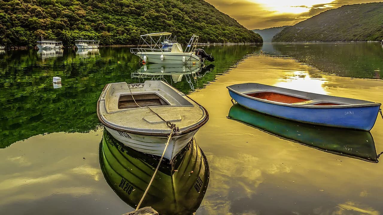
The Lim fjord is not a fjord. It is a narrow, flooded karst channel on Istria's west coast, 11 kilometres long, protected as a landscape and special marine reserve, and best seen from the water on a boat trip from Rovinj, Poreč or Vrsar. This guide covers what the channel actually is, where it sits, why everyone calls it a fjord and how the boat trip and the roadside view compare.
Expect steep wooded slopes on both sides, a mix of fresh and salt water that makes the sea noticeably less salty, and a shoreline dotted with caves and old monuments rather than beaches. Plan the Lim as a half-day outing that slots into a wider Istria itinerary rather than a destination in its own right.
A flooded karst channel, not a glacial fjord
A true fjord is carved by glaciers; the Lim is a drowned river valley in limestone, flooded by the sea. That geology explains the shape: a long, narrow inlet with high sides that closes into a sheltered channel rather than opening onto a wide bay. The label is marketing convenience, not a scientific description, and you should read any 'fjord' sign in that light.
The channel reaches 11 kilometres inland from the coast, as Maistra records. You travel a genuine distance into the landscape rather than circling a small cove, which also means you cannot see the best of the Lim from a single roadside stop.
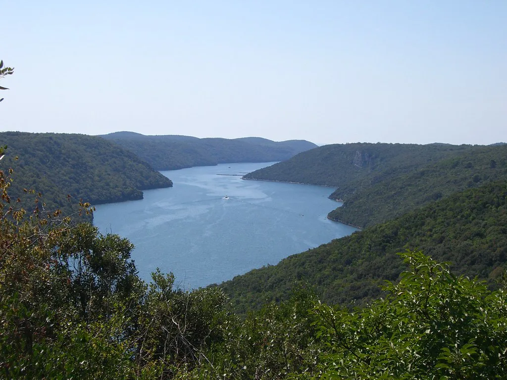
Where the Lim sits between Rovinj and Vrsar
The channel opens to the sea on Istria's west coast between Rovinj and Vrsar, and all three towns — Rovinj, Vrsar and Poreč to the north — work as starting points for excursions into it. If you are basing yourself in any of them, the Lim is an easy add-on rather than a separate journey.
Use the Istria map to see how the inlet cuts inland and how it relates to the rest of the peninsula before you fix your route. Seeing the channel's length on the map is the quickest way to understand why a boat covers it better than a short stop on land.
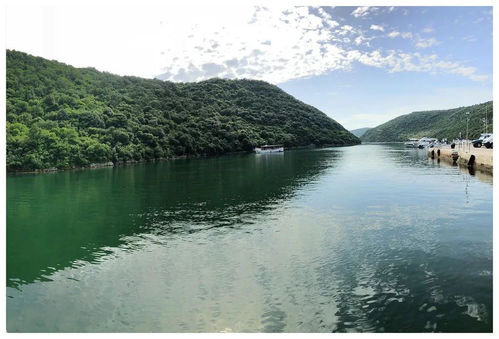
Why it is called a fjord: the 1958 film Vikings
The nickname comes from cinema. The 1958 film Vikings, starring Kirk Douglas, used the channel as a stand-in for a Norwegian fjord, and the name stuck after release, as Maistra records. That is the whole of the connection: a location decision by a film crew, later adopted by tourism.
Locals more often say Lim, and Croatian sources use Limski kanal or Limski zaljev — the Lim channel or Lim bay. Any of these names on a sign or timetable refers to the same place, so do not go looking for a second, separate fjord.
Protected landscape and marine reserve
The Lim is designated a protected landscape and a special marine reserve, which shapes what you can do there. Expect nature protection rules rather than resort development along the water, and treat the slopes and the seabed as the attraction. The status is the reason the channel still reads as wild rather than built-up.
Practical consequence: organised swimming and snorkelling happen within excursion arrangements rather than from open public beaches along the channel. If swimming is the main reason you are going, book a trip that includes it; there is no easy public entry point to the water along the channel.
Wooded slopes, caves and St Romuald's Cave
From the water the Lim looks like a green corridor: dense forest runs down both sides to the waterline, with historical monuments and wildlife habitats tucked into the slopes. Maistra names St Romuald's Cave among the monuments on the channel, a reminder that this is a lived landscape rather than empty scenery.
The scale works against you on a quick visit: a short stop on land shows a bend of the channel, not the eleven kilometres of it. Boats cover the distance and let you see the alternating wooded spurs and open water; if you only have time for a brief look, accept that you are seeing a fraction of the whole.
How the boat trips work
The typical format is a panoramic cruise into the channel with time for swimming, snacks and a drink, and a lunch of local seafood, with the whole package included in the excursion price. Maistra describes exactly this combination, including mussels and oysters farmed in the bay and served at a nearby restaurant. Book through Maistra or the hotel concierge and ask what the price covers before you pay.
Departure points cluster around Rovinj and Vrsar, with Poreč also serving the channel. Schedules and season dates shift with the summer season, so ask the booking office about the departure port, sailing time and what is included when you book rather than relying on a leaflet from last year.
Why the water is less salty
The Lim has a lower salinity than the open Adriatic because fresh water mixes into the channel, a feature Maistra highlights as something you notice when you swim. That combination of fresh and salt water also makes the bay rich in fish and suited to shellfish farming.
Swimming and snorkelling are usually built into the excursion rather than done independently, so check that your trip includes a stop for it. Treat the swim as a bonus rather than the purpose of the day, since comfort in the water shifts through the season.
Caves and monuments along the slopes
Above the waterline the wooded slopes carry caves and historical monuments, and the height of the sides makes the inlet feel enclosed as you move through it. Read the rock and the forest as the attraction rather than looking for a beach.
The essential facts are the geography: a narrow flooded inlet on Istria's west coast, 11 kilometres long, opening to the sea between Rovinj and Vrsar. That is enough for orientation, and the 'fjord' label describes its shape, not a glacial origin.
Boat trip or roadside viewpoint?
The trade-off is time and money against completeness. A boat trip takes the best part of a day, includes food and swimming and shows you the length of the channel; a short stop on land costs little time and shows you one bend. If the Lim is a filler between Rovinj and the hill towns, that short stop is enough.
If it is the centrepiece of a day, take the boat. Travellers with limited patience for group excursions, or with children who need to move, often prefer a shorter look and a drive inland instead. Both are legitimate ways to see the same landscape.
When to go, crowds and the bura
The boat season runs through the warm months, when excursions into the channel operate and swimming is comfortable. July and August bring the heaviest demand, so book ahead and expect shared boats rather than private space. Outside those weeks, confirm that trips are still running before you build a day around one.
The bura, the cold north-easterly wind, can make the exposed water uncomfortable and can affect sailings, so sea conditions are worth checking. Build flexibility into your plan so an unsettled morning does not cost you the whole trip.
On a windy or uncertain day, keep an inland alternative ready. The walled hill towns of the Istrian interior make a sensible fallback when the sea is unsettled and boats are staying in port.
Boat trip or a short stop?
Take the boat if you want the full eleven kilometres, the swim in less salty water and a lunch built around the bay's shellfish. Take a shorter look on land if the Lim is one stop among many and you would rather spend the time inland.
Either way, slot it into a wider Istria plan so a windy day or a full boat does not derail the trip. Confirm departure times and what the price includes directly with the boat company before you commit.
Explore more Istria guides
- Bale, Croatia
- Buzet: A Guide to Istria's Hilltop Truffle Town
- Fažana: Istria's Fishing Village and the Gateway to Brijuni
- Grožnjan
- Hum, Croatia
- Labin: A Guide to the Hilltop Old Town Above Rabac
- Motovun: a guide to the walled hilltop town in Istria
- Oprtalj: Istria's Hill Village of Frescoed Churches and Mirna Valley Views
- The Istria Coast
- Vodnjan: Istria's Old Town, St Blaise Church and How Long You Need
- Vrsar, Croatia
- Dvigrad: the abandoned medieval town in the Draga valley
- Pazin Castle
- Roč, Croatia
- Savudrija Lighthouse
- Svetvinčenat
Frequently Asked Questions
Can you swim in the Lim fjord?
Yes, but usually as part of an organised boat excursion rather than from public beaches along the channel. Swimming and snorkelling stops are typically included in the trip, and the water is less salty than the open Adriatic because fresh water mixes into the channel.
How deep is the Lim fjord?
No reliable depth figure is available for the channel, so plan around its length and shape instead. It is a flooded karst valley, 11 kilometres long, with steep wooded sides, which is what makes it feel enclosed.
Is the Lim fjord worth visiting?
Worth it if you want a half-day on the water with a swim and a seafood lunch, or a striking view from the road if you are passing between Rovinj and Vrsar. Skip it if your time in Istria is short and better spent in the hill towns.
Sources
Notes from the Croatian coast
Optional updates when our guides change.
You might also like
Continue reading
More guides you'll find useful