Dugi Otok: An Island Guide to Sali, Božava and Telašćica
Plan a Dugi Otok trip: ferry and catamaran routes from Zadar, which village to base yourself in, and what Telašćica and the island's sights need.
On this page
Dugi Otok suits travellers who want a slow, uncrowded island and accept that logistics take planning. It runs about 45 km from end to end and only a few kilometres wide, which is where its name, Long Island, comes from, and its villages sit on the calmer eastern shore while the western coast is rugged and cliff-backed. This guide covers the four ports, the villages, Telašćica and Kornati, getting around and the climate, so you can decide how to split a stay.
The trade-off is straightforward: you get space, silence and clear sea, but you do not get nightlife, large resorts or an easy bus network. Treat it as a place to slow down rather than a base for ticking off sights, and plan the boat trips and the National Park into separate days.
What Dugi Otok is like
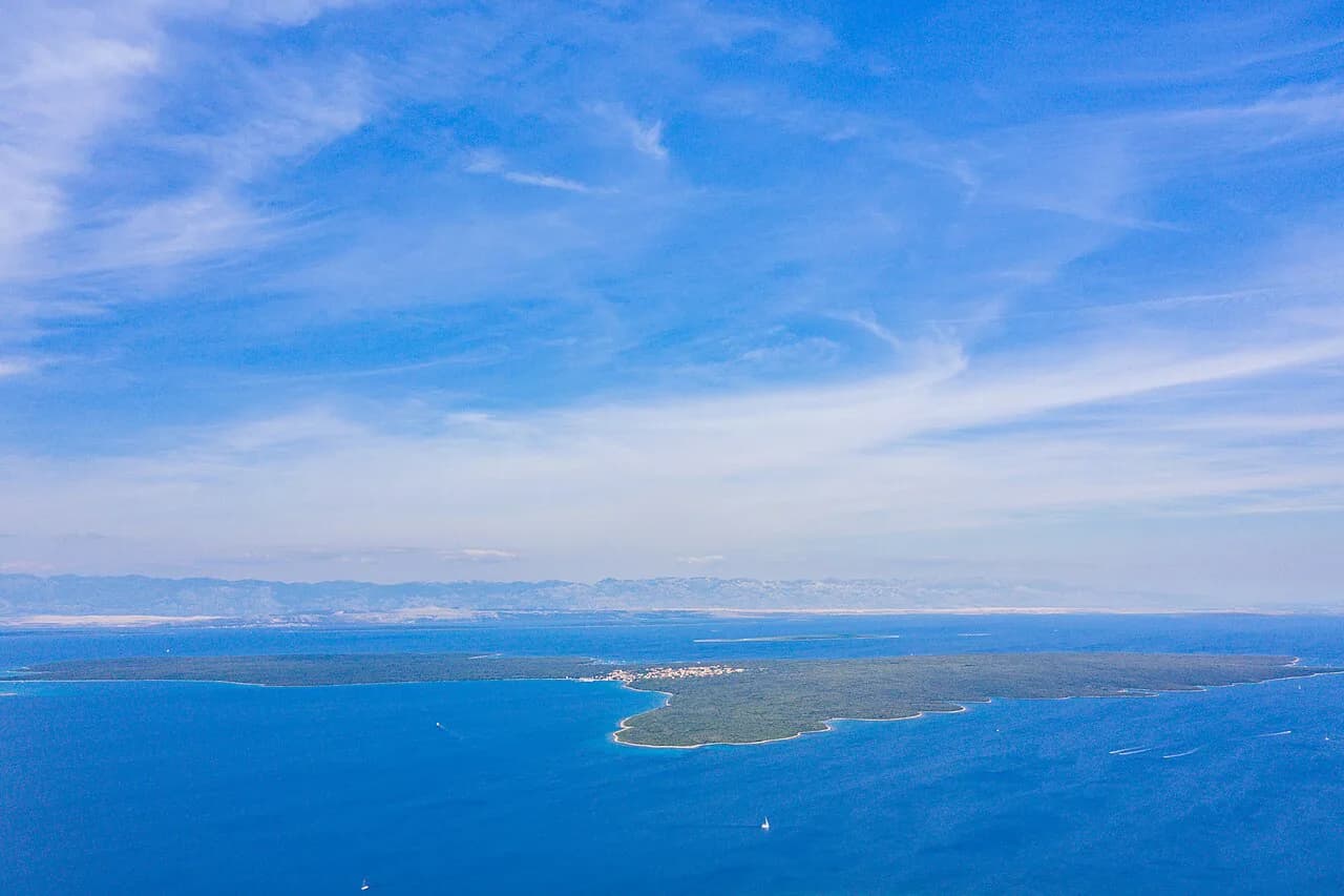
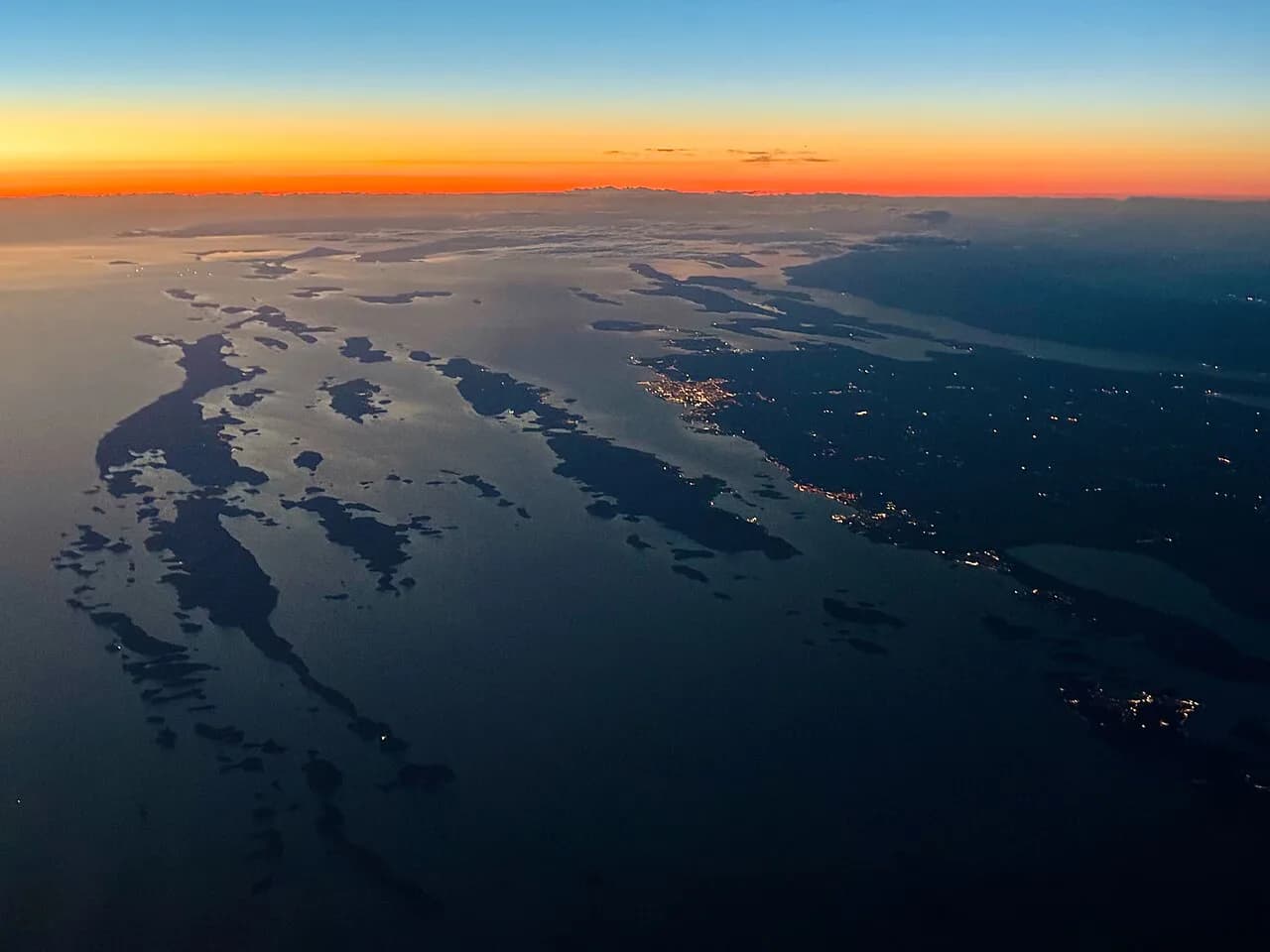
Dugi Otok is the largest island in North Dalmatia and the seventh largest in the Adriatic, lying west of Zadar. Its long, narrow shape means the western side is tall and rugged while most settlements, including Sali, Božava, Brbinj, Dragove, Soline, Zaglav and Žman, sit on the eastern side. Around 1,600 people live on the island year-round, which tells you most of what you need to know about how built-up it feels.
The southern part of the island is dominated by Telašćica Nature Park, with cliffs and coves on that stretch of coast. Plan your days around distance rather than attractions: the island is long, the road network is thin and the drive between the northern villages and the Telašćica end eats a chunk of any day.
This is an island for quiet beaches and open water rather than a packed itinerary. The clear sea and the unbuilt coastline are the point, and the appeal fades for anyone who wants bars, clubs or a resort atmosphere.
How to get there: four ports and which village each one serves
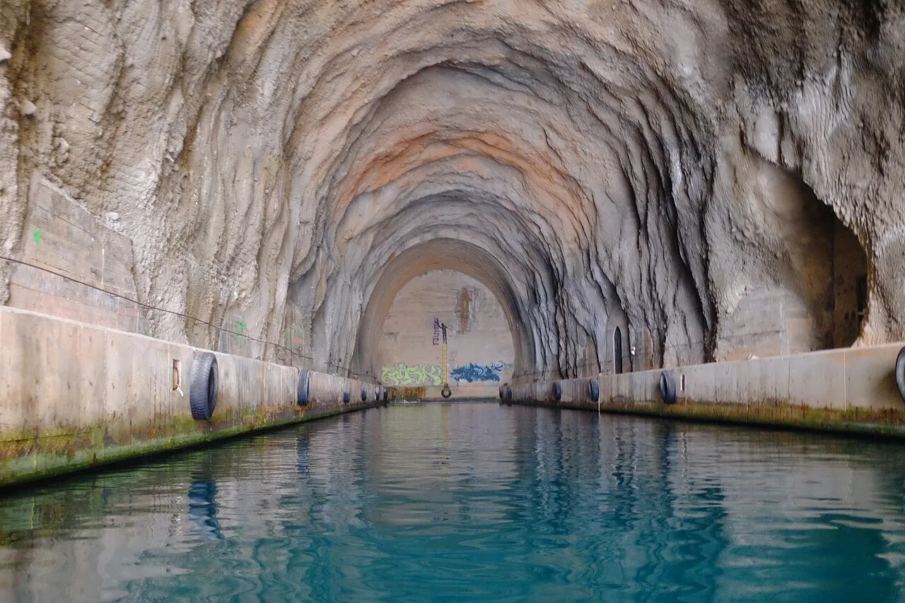
Dugi Otok has four ports: Brbinj, Božava, Zaglav and Sali, and the one you pick determines where you land and how much of the island you then have to cross. Brbinj sits between two bays on the north-east side and is the car-ferry port from Zadar, so it is the arrival point for anyone bringing a vehicle. Božava is on the north-west side, Zaglav is about 1.5 km north of Sali on the east coast, and Sali is the largest town on the island.
Match the port to your base before you book. Brbinj and Božava work for the northern villages, Zaglav is a short hop from Sali, and Sali itself is the best-served base for the southern end and the Telašćica approach. If you are comparing options across the region, the wider group of islands near Zadar shares the same Zadar departure point.
Tickets can be bought at ferry terminals as well as in advance online. Buy ahead in high season if your arrival time is fixed, because the Zadar crossings are the island's only practical link with the mainland.
Journey times from Zadar and high-season departures
From Zadar, the car ferry to Brbinj takes around 1 hour 45 minutes, and the catamaran crossing to Božava is around 1 hour 20 minutes. Jadrolinija, which runs the Zadar crossings, also lists a catamaran link between Božava and Brbinj. Departures to Brbinj and Božava are more frequent in high season than at other times of year, so in the shoulder months compare the timetable against your dates instead of counting on a summer pattern.
If you are flying, Zadar Airport is about 12 km from the city, and a shuttle runs to the main bus station. From the bus station or the ferry terminal you continue by ferry or catamaran. Arrive in Zadar with time to spare rather than booking a flight that lands close to your sailing.
Getting around without a car
Public transport on the island is minimal: the one bus service runs between Božava and Brbinj, timed to connect with the ferry, and there is also a catamaran link between the two. That is useful for a transfer but not for exploring, so a short stay without your own vehicle quickly becomes a series of compromises.
Cars are rented in Zadar, not on the island, so bringing one over on the Brbinj ferry is the practical choice if you want to cover ground. Scooters and boats can be arranged through travel agencies on the island. For a stay of a few days, weigh the ferry cost of a car against the time you would otherwise lose waiting.
Sali: the island's largest town
Sali sits on the south-eastern coast and is the island's largest town. It is the natural base for the southern end, including the Telašćica approach, without a long drive each morning. For the town in detail, see the guide to Sali on Dugi Otok.
Zaglav, about 1.5 km north of Sali, gives you a second arrival option on the same stretch of coast. Staying in Sali and using Zaglav's connection is a reasonable combination if the catamaran times suit you better on one leg of the trip.
Božava and the northern villages
Božava lies on the north-west side and is reached by catamaran from Zadar in around 1 hour 20 minutes, making it the easiest landing point for the north of the island. Brbinj, Dragove, Soline, Zaglav and Žman are the other named settlements, spread along the eastern shore and inland, and each is small enough that the village itself takes an hour or so rather than a day.
At the northern tip stands the Veli Rat Lighthouse on Dugi Otok, the island's best-known landmark on that end of the island. Pair it with a slow day in the northern villages rather than treating it as a quick stop on the way south.
Telašćica Nature Park
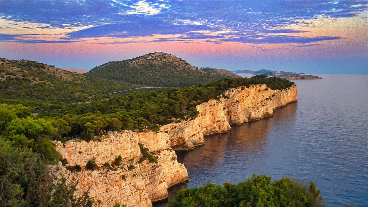
Telašćica Nature Park occupies the southern part of the island and is its main natural sight, with dramatic cliffs and a coastline of coves. It is on Dugi Otok itself, so you reach it by road from Sali or the southern villages rather than by boat trip. Set aside a half-day at minimum, and more if you want to walk any of the park.
Entry arrangements, opening times and any charges at Telašćica are set by the park authority and change with the season, so check them before you go rather than budgeting from an old figure.
Kornati National Park by boat
Kornati National Park lies a short boat ride from Dugi Otok and takes in more than 100 uninhabited islands surrounded by very clear sea, with a raw, dramatic landscape that many visitors rate as the highlight of their trip. It is a separate National Park from Telašćica, so it needs its own day and its own boat.
Boat trips run from the island, and availability in summer is limited, so book the trip ahead rather than on arrival. Ask the trip company which park entrance and which landing point it uses, then confirm the park's own ticket terms separately.
Where the island's shape affects your day
Because Dugi Otok is long and narrow, the distances between the northern villages, Sali and the southern park are the main planning constraint. A day that pairs Veli Rat with Telašćica is a day spent largely in the car. Group the north on one day and the south on another, and keep the boat trip to Kornati as a third.
The thin road network and the single bus route reinforce the same point: without a vehicle, you are tied to the Božava to Brbinj link and to anything your accommodation can arrange. Decide early whether you are touring the island or staying put in one village, because the two plans need different bookings.
When to go: temperatures and winds
Dugi Otok has a mild Mediterranean climate with dry, warm summers and mild, rainy winters. Average summer temperatures sit around 26°C and the average sea temperature reaches around 24°C in July and August, the warmest period. Treat these as typical climate averages for planning, not as a forecast for your week.
Winds shape the days here. Bura usually blows in winter and jugo is common in spring and autumn, while the summer wind is mostly the gentle maestral from the west. For a summer visit that matters little, but in the shoulder months the bura can affect boats and how exposed the western coast feels.
How long you need and how to split a stay
Split the stay between the north and Sali if you can, so the long drive is done once rather than every day. A workable shape is two nights in the north for Božava, Brbinj and Veli Rat, then two more around Sali for Telašćica and the Kornati trip.
Book the catamaran or ferry legs around that split, and keep the middle day free for the boat. Whichever end you sleep in, the distances mean the car stays useful throughout.
Sakarun and the quieter coves, in brief
Sakarun, with its white sand and shallow turquoise water, is the island's best-known beach. The quieter swimming is found in the coves beyond it, many of which are reached on foot, by bike or by kayak rather than by car.
Cycling the coastal routes and paddling in the calm morning water are the low-key ways to reach those spots. Bring what you need for the day, since facilities thin out away from the main beach.
Practical points: supplies, cash and car hire
Sort out your vehicle before you travel, because cars are rented in Zadar and not on the island. Scooters and boats are arranged through agencies on Dugi Otok itself, so ask your accommodation which agencies are operating when you visit.
Croatia uses the euro, so there is no need to change money into kuna. Carry some cash for small places, and stock up on supplies in the larger villages before heading to quieter coves or the park.
Who Dugi Otok suits, and who it does not
Dugi Otok suits travellers who want quiet beaches, clear swimmable sea, open space and a slower pace, and who are happy to plan ferries and a vehicle. It is a poor fit for anyone who wants nightlife, a resort atmosphere or easy logistics without a car.
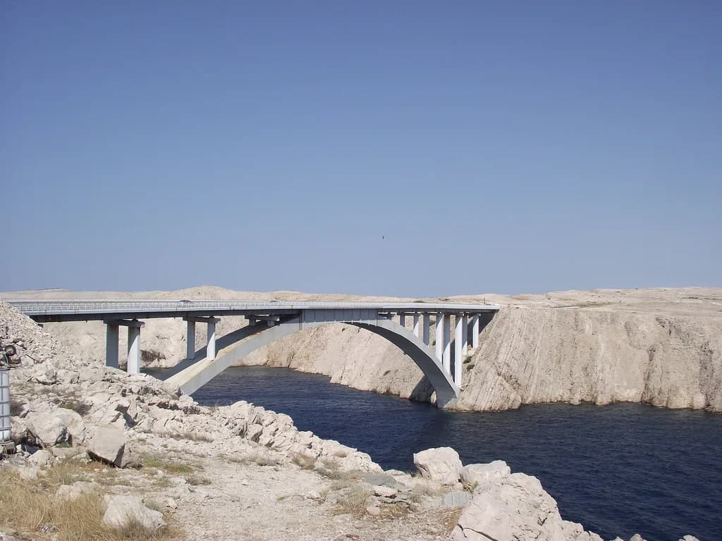
If you want a car-free island or a busier base, look elsewhere in the Zadar archipelago instead: Silba for a car-free stay, or Ugljan Island for a shorter hop across the Zadar Channel. Pag island, reached by the Pag bridge, gives you a very different, more developed coastline.
Should you base yourself in Sali or the north?
Choose Sali if Telašćica and the Kornati boat trip are your priorities, because the southern end of the island is on your doorstep and the catamaran from Zadar lands you on the right coast. Choose Božava or Brbinj if you want the northern villages and Veli Rat without a daily drive.
Whichever you pick, bring or hire a car in Zadar, book the Kornati boat before you arrive, and keep the ferry or catamaran times flexible around the season. For the wider comparison, see the other islands near Zadar.
Explore more Zadar guides
Frequently Asked Questions
How long is the ferry from Zadar to Dugi Otok?
The car ferry from Zadar to Brbinj takes around 1 hour 45 minutes, and the catamaran from Zadar to Božava takes around 1 hour 20 minutes. Departures are more frequent in high season.
Do you need a car on Dugi Otok?
It is the practical choice for a short stay. The island's public transport is limited to a bus between Božava and Brbinj timed to the ferry, plus a catamaran link between the two. Cars are rented in Zadar rather than on the island, while scooters and boats can be arranged through agencies on Dugi Otok.
Can you visit Kornati and Telašćica on the same day?
They are two different places and deserve separate days. Telašćica is a Nature Park on the southern part of Dugi Otok that you reach by road, while Kornati National Park is a group of more than 100 uninhabited islands reached by boat. Trying to combine them means a rushed day with a lot of time in transit.
Sources
Notes from the Croatian coast
Optional updates when our guides change.
You might also like
Continue reading
More guides you'll find useful