Rovinj Map: Decide Old Town, Harbour & Sights Layout
A visitor's map of Rovinj explained: the old town peninsula, harbour, main square and nearby green spaces, plus how the town links to its bus station.
On this page
Rovinj reads as two maps in one: a compact old town piled onto a headland, and a harbour-front town spread out behind it. Get that relationship straight and you can walk the whole centre without a wrong turn. This guide lays the town out by area, explains how the lanes climb to the church of St Euphemia, and shows where the waterfront, the main square, the forest park and the bus station sit in relation to each other.
What the Rovinj map shows at a glance
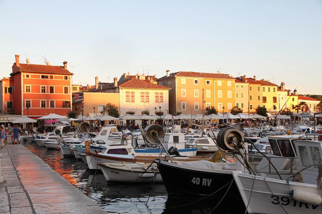
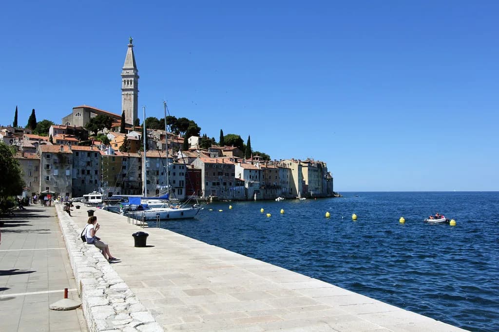
The old town occupies a small peninsula, with the harbour tucked along its landward side and the newer town spreading inland from there. Because the peninsula is small, almost everything visitors come for sits within a short walk of the water. The Rovinj-Rovigno Tourist Board publishes its own orientation material for the town, including a 360-degree panorama and a webcam, which help before you arrive.
Think of the map in layers: the headland lanes at the top, the harbour and Riva along the inner edge, then the ordinary town of shops, parking and the bus station beyond. Most confusion comes from treating the old town as a grid it never was. Once you accept that the lanes spiral upwards to one landmark, navigation becomes a matter of walking towards the hill, and our things to do in Rovinj guide picks up the practical options once you are there.
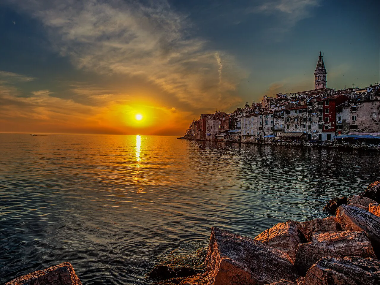
The old town peninsula and the climb to St Euphemia
The lanes of the Rovinj old town climb towards the church of St Euphemia, whose bell tower is the one point visible from almost everywhere below. That makes it the orientation point: if you can see the tower, you can find your way back down. The street pattern loops and doubles back rather than running straight, so progress is measured in steps gained rather than distance covered.
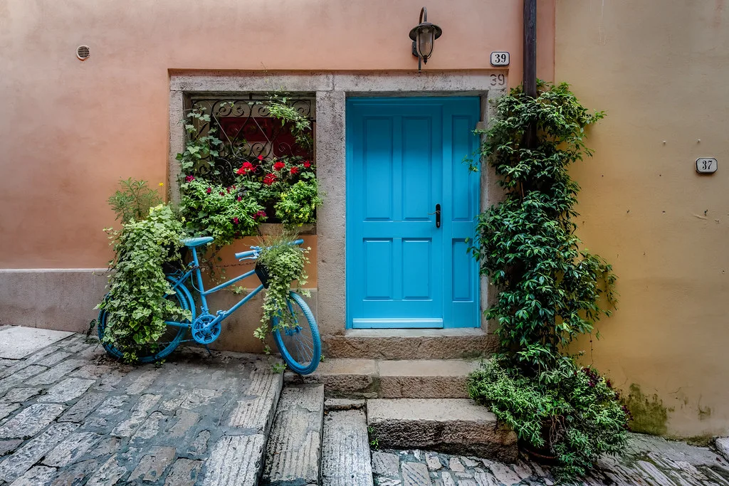
Treat the climb as the spine of your visit and plan the rest of the old town around it. Front doors open directly onto lanes, and polished stone underfoot turns slick in rain, so footwear matters more than any shortcut on the map. Give the peninsula more time than its size suggests, because the pleasure is in the wandering rather than the transit. If you want the stops ordered for you, our walking tour lays the old town out step by step.
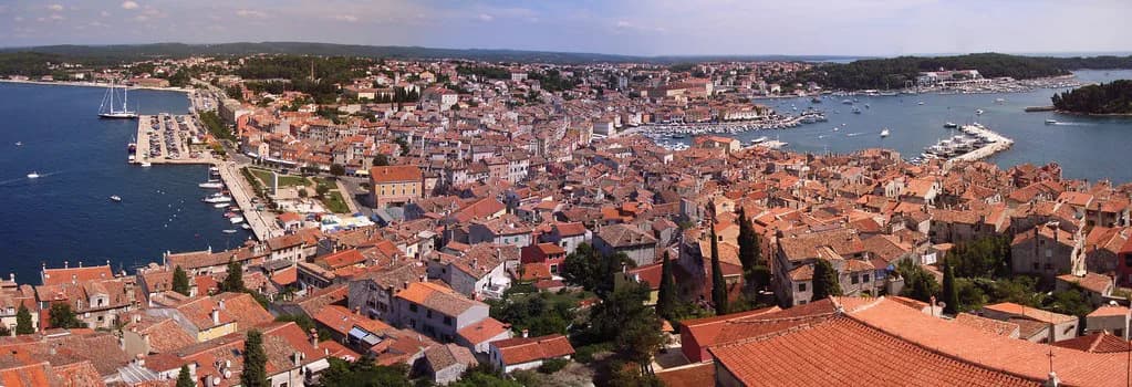
The harbour and the Riva
The harbour runs along the inner shore of the peninsula, and the Riva is the waterfront promenade where the town meets its boats. This is the edge that connects the old town to everything landward: the market, the boat departures and the streets leading back into the modern town. Boat trips leave from this side, so the harbour is where you begin and end any time on the water.
Use the Riva as your map's baseline. From here, the old town rises ahead of you and the modern town runs behind, which means almost every route you plan inland can be reversed from the waterfront. Fishing boats and excursion vessels tie up along the same stretch, so allow for a slower walk when a departure is loading.
Marshal Tito Square as the hinge
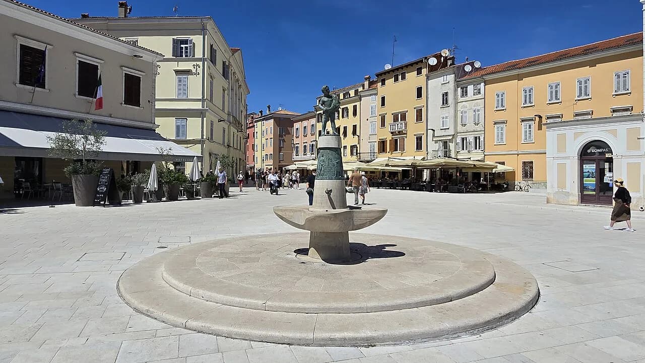
Marshal Tito Square is the hinge between the old town and the modern town: the lanes of the peninsula open onto it, and streets fan out from it towards the rest of Rovinj. If you orient yourself here first, both halves of the map fall into place. It also works as a meeting point, since anyone coming from either direction passes through it.
From the square, walk into the lanes and up to the church, then return by a different lane to the harbour and follow the Riva back. That loop covers the essential map of the centre in one continuous line, with the square as start and finish. Everything else in town, from shops to the bus station, branches off that circuit rather than sitting in the middle of it.
Green space on the same map: Zlatni rt and Punta Corrente
On the landward edge of the centre, the Golden Cape Forest Park, Zlatni rt, extends to the Punta Corrente headland and gives the town a wooded fringe within walking distance of the old town. It is the closest thing to a green escape on the same walkable plan as the old town, and the tourist board lists it among Rovinj's natural attractions. Give yourself a clear direction before setting off, because the park opens out well beyond the first clearing.
Coastal paths and marked trails run through the park, and the tourist board publishes route information for cyclists and walkers. Distances on paper rarely match the time spent, because shaded tracks and viewpoints pull you off the direct line. Allow for a half-day if you want to reach the headland properly rather than turning back at the first clearing.
Islands and boat trips from the harbour
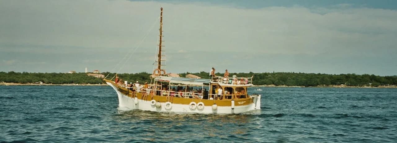
The Rovinj archipelago lies offshore, and the boat trips that serve it leave from the harbour, making the waterfront the map's departure point for anything afloat. The tourist board lists boat rides around the Rovinj islands among the excursions available from town. Booking is done with the boat operators who work the harbour, and schedules shift with the season, so check current departure times before you set out. Our boat trips from Rovinj page gathers the routes worth considering.
Boat trips also run further afield, including to Brijuni National Park and along the Lim Channel, both of which the tourist board describes as excursions from Rovinj. These are longer outings than a loop of the islands, so they change the shape of your day rather than simply adding a stop. Decide before you walk down to the harbour whether you want a short crossing or a full excursion, because the two use different vessels and departure slots.
Getting in and out: bus station and arrivals
The bus station sits in the modern town, inland from the old town and the harbour, so arrival puts you on the landward side of the map. From there it is a walk through the newer streets to Marshal Tito Square and then into the lanes. The tourist board's plan-your-journey pages cover reaching Rovinj, along with car parking and the tourist road train.
Arriving by air means reaching Istria first and continuing by road or bus, and the tourist board sets out the options on the same journey pages. A regional map helps here: Croatia's western coast runs down the Istrian peninsula, with Rovinj on its shore.
A walking loop that uses the map properly
Start at Marshal Tito Square, take one lane up through the old town to St Euphemia, and come down by a different lane to the harbour and the Riva. Follow the waterfront, then cut back through the square, which returns you to where you began. This order uses the map's natural fall lines, so you climb once while keeping the rest of the day level.
If you have a second block of time, spend it on the Golden Cape Forest Park rather than adding more lanes, since the lanes repeat themselves while the park does not. Anyone who wants a scheduled, guided version of the centre can join one of the tourist board's city tours, which are listed with meeting points on its site. Anything else worth seeing indoors can wait for poor weather.
Map pitfalls: hills, traffic and summer crowds
Two things regularly catch visitors out on the map. The first is the climb: lanes on the peninsula gain height steadily, so a short line on paper can be a puffing ascent with bags. The second is traffic, since the old town is closed to ordinary driving and cars are left in the town car parks, whose locations and charges the tourist board publishes.
In high summer, the lanes and the Riva fill up, so the same route takes noticeably longer and the map's short hops stretch. Walk the old town early and save the harbour and forest park for the busier middle of the day. Cruise traffic and day visitors concentrate in the same narrow streets, so treating distance as time rather than metres is the more honest way to plan.
Which corner of the map to start with
Start at Marshal Tito Square, climb once to St Euphemia, drop to the harbour and walk the Riva back. That single loop gives you the old town, the waterfront and the orientation you need, and leaves the Golden Cape Forest Park and the boat trips as separate blocks of the day rather than add-ons.
Croatia uses the euro, and the tourist board publishes current parking charges and excursion details on its own pages. For the wider picture of what to see once you have your bearings, start with Things to Do in Rovinj: Old Town, Bell Tower and Boat Trips, which picks up the practical options from this loop.
Explore more Rovinj guides
Frequently Asked Questions
What is the closest airport to Rovinj, Croatia?
Rovinj has no airport of its own. Arrivals reach Istria by air and continue by road or bus, and the Rovinj-Rovigno Tourist Board's plan-your-journey pages set out the connections and onward transport options.
How many days do I need in Rovinj?
One full day covers the old town loop from Marshal Tito Square up to St Euphemia and back along the harbour. Add a second day for the Golden Cape Forest Park and a boat trip into the Rovinj archipelago, since both take a half-day each on their own.
What was filmed in Rovinj?
Screen productions shot in Rovinj change over time, and no reliable current list applies to your visit. If a specific film brought you here, ask the tourist board.
Sources
Notes from the Croatian coast
Optional updates when our guides change.
You might also like
Continue reading
More guides you'll find useful